
Although most people think of Las Vegas as a city filled with casinos, nightlife, and entertainment, it is also a great place to hike. And with its convenient location in the Mojave Desert, it will take you less than an hour to find amazing natural scenery with plenty of hiking trails.
You don’t have to be an experienced hiker to find a trail that’s perfect for you, there are trails of all levels here. So whether you’re looking for an easy nature walk or a challenging hike, here is a list of the 10 best hiking trails near Las Vegas.
Hiking Trails Near Las Vegas, Nevada
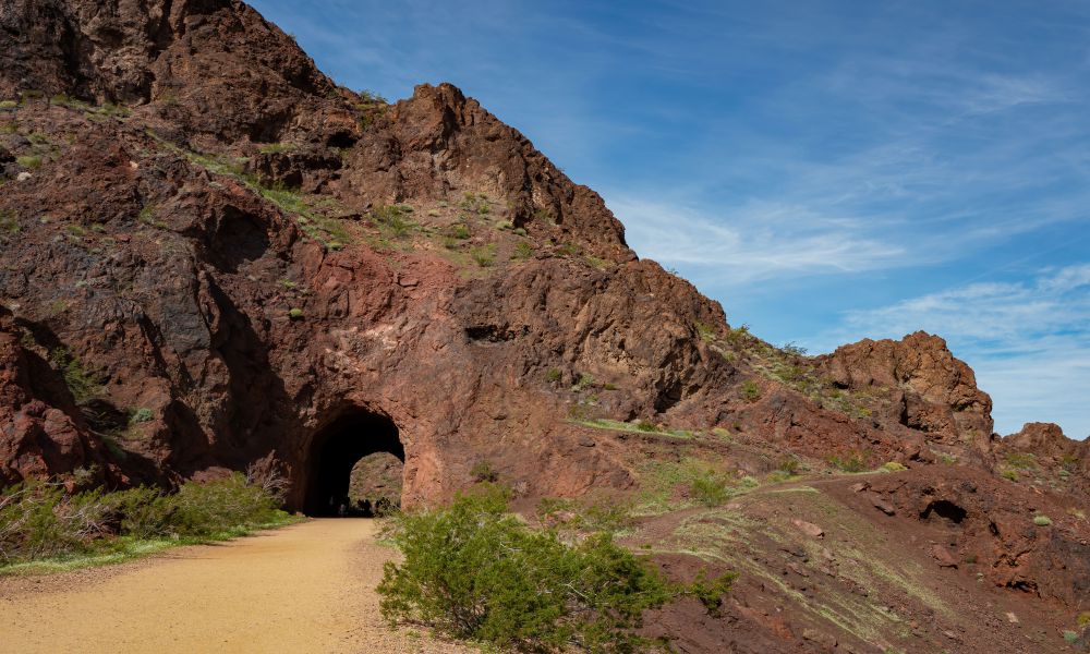
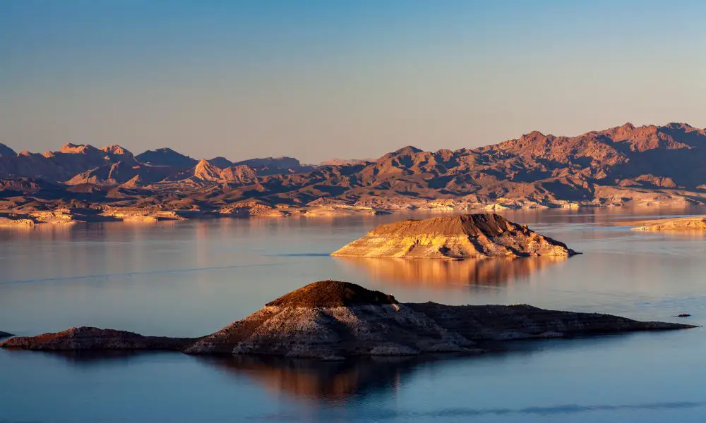
1. Historic Railroad Trail
• Distance: 7.5 miles
• Difficulty: Easy
• Elevation Gain: 11 feet
• Location: Lake Mead National Recreation Area
If you’re looking for easy and scenic hikes near Las Vegas, the Historic Railroad Trail is a great option. The trail follows an old railroad grade that was once used to transport supplies to the Hoover Dam construction site in the 1930s.
Today, the trail is a popular recreation spot for locals and visitors alike. It’s a great option for a leisurely day hike or a family-friendly nature walk.
The trail is 7.5 miles long, making it a great option for a half-day hike. It’s mostly flat, with an elevation gain of only 11 feet, so it’s suitable for all fitness levels. And the best part? The trail passes five tunnels and offers amazing views of the nearby landscape. Each tunnel is about 300 feet long and offers a cool respite from the heat.
The trailhead is located at Lake Mead Visitors Center, about 30 minutes from Las Vegas. Be sure to stop by the visitor center before starting your hike. You’ll find maps and helpful information about the trail and the area’s history. And along the way, you’ll see some of the local wildlife, including bighorn sheep and Rabbits.
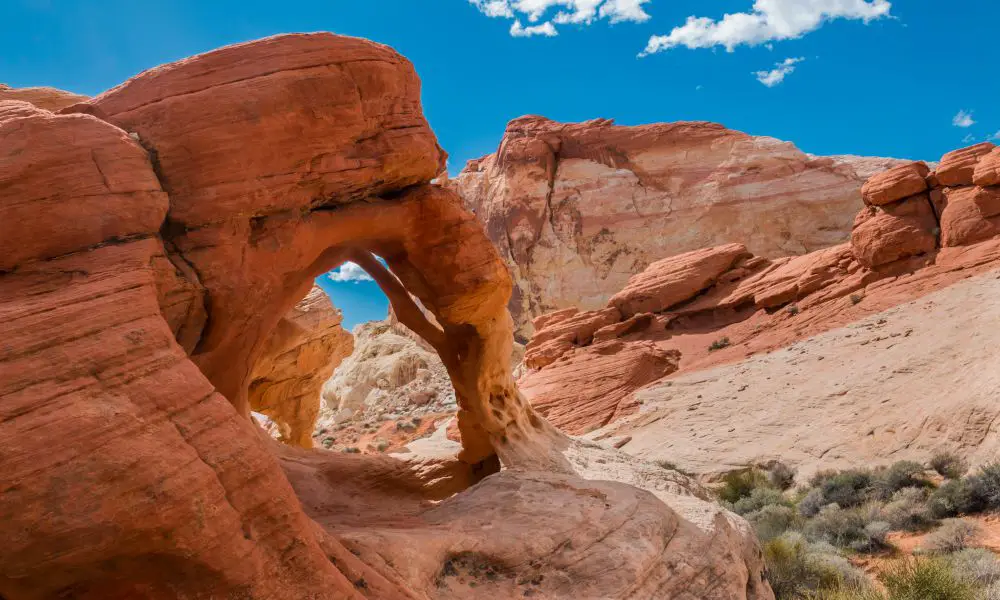
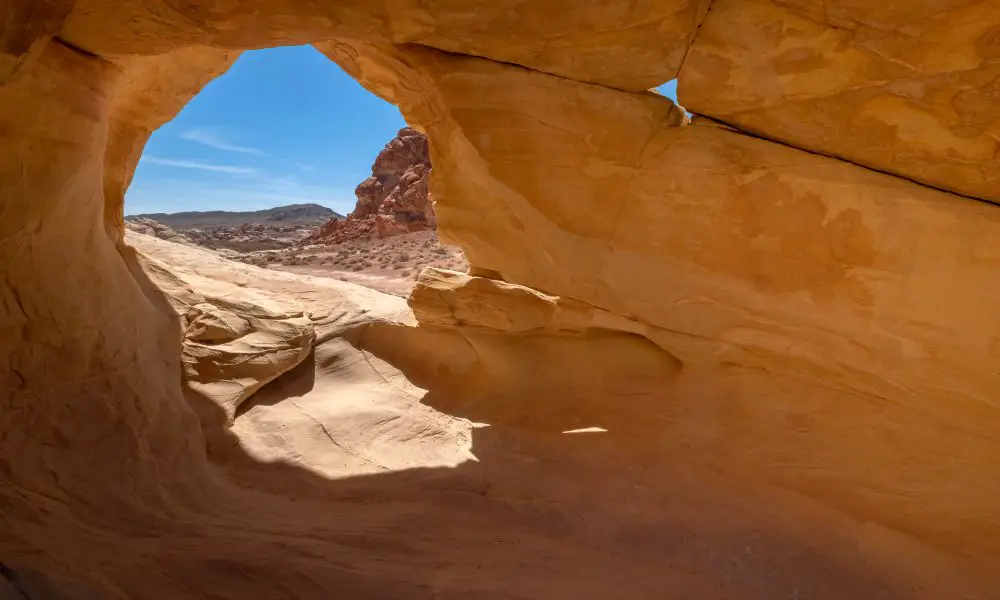
2. Fire Wave
• Distance: 1.2 miles
• Difficulty: Easy
• Elevation Gain: 236 feet
• Location: Valley of Fire State Park
This is one of the most unique and photographed trails near Las Vegas. The Fire Wave is located in the Valley of Fire State Park, about an hour’s drive from the city.
The 1.2-mile out-and-back trail is fairly easy, with an elevation gain of only 236 feet. The real challenge is the heat; summer temperatures in the Valley of Fire often exceed 100 degrees. The best time to hike this trail is in the early morning or evening when it’s cooler.
The trail itself is fairly flat and follows a wash into the sandstone formation. The wave-like formation of the sandstone is otherworldly, and you’ll want to take your time hiking through it. In fact, this place was used as the filming location for Star Trek Generations.
The best time to photograph the Fire Wave is in the late afternoon when the sun is low in the sky and casts a warm glow over the rocks. Be sure to bring plenty of water and sunscreen, as there is little shade on the trail.
Due to its uniqueness, you may find yourself hiking greater distances to enjoy the scenery. There are also side trips to other interesting rock formations in the area, so be sure to leave yourself plenty of time to explore.
All in all, the Fire Wave is an easy hike that offers stunning scenery. It’s one of the best hiking trails near Las Vegas for photography lovers and anyone who enjoys exploring otherworldly landscapes.
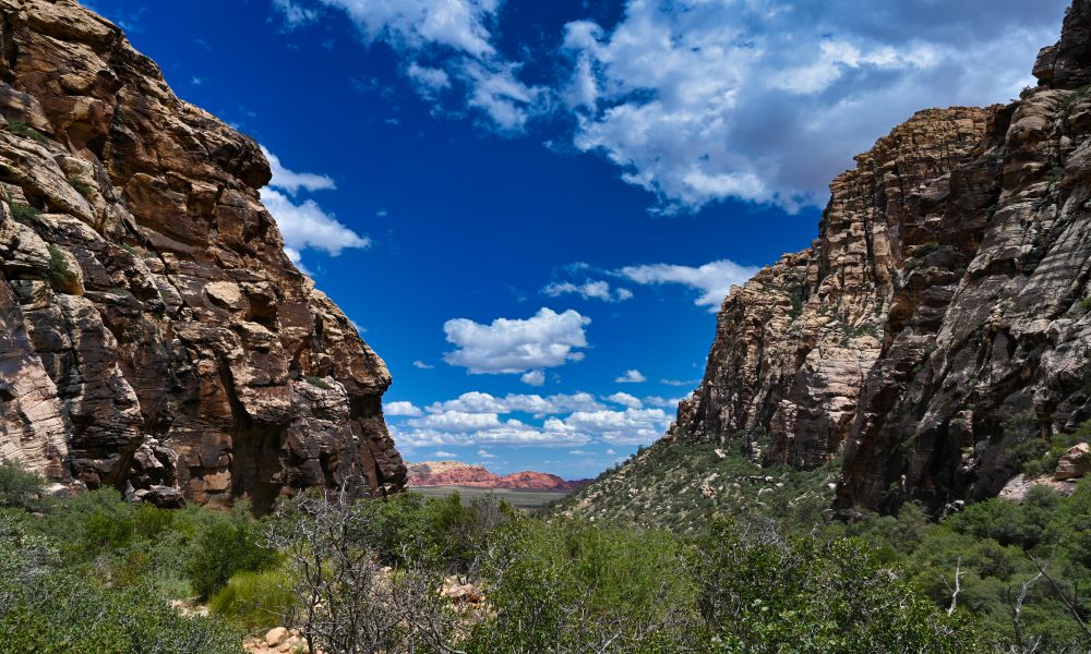
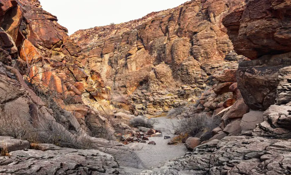
3. Icebox Canyon
• Distance: 2.6 miles
• Difficulty: Moderate
• Elevation Gain: 580 feet
• Location: Red Rock Canyon National Conservation Area
Icebox Canyon is a great choice when you’re looking for the best hikes near Las Vegas that offer a little bit of everything. Located in the Red Rock Canyon National Conservation Area, the 2.6-mile out-and-back trail is rated moderate due to its elevation gain of 580 feet.
The trail is fairly easy to follow and takes you through a canyon shaded by tall cliffs. The trail winds its way through the desert-like landscape and offers stunning views of the canyon walls. And as you hike through the canyon, you’ll be treated to a variety of desert plants and wildlife. The canyon is also home to a number of different birds, so keep your eyes peeled for some feathered friends.
The trail ends at a huge canyon wall, which is the perfect spot to take a break and enjoy the view. If you’re feeling adventurous, you can even do some scrambling to get to the top of the wall for an even better view. But be careful, as the rocks can be slippery.
And since it’s located just a short drive from Las Vegas, it’s the perfect place to get away from the city for a day. Just be sure to bring plenty of water, as there is no water available on the trail. And if you’re hiking in the summer, be sure to start early to avoid the heat.
4. Petroglyph Trail
• Distance: 4.4 miles
• Difficulty: Moderate
• Elevation Gain: 557 feet
• Location: Sloan Canyon National Conservation Area
The Petroglyph Trail in the Sloan Canyon National Conservation Area is one of the best hiking trails near Las Vegas for history buffs. The trail winds through a landscape littered with ancient petroglyphs, some of which are over 2,000 years old.
The petroglyphs were created by the Ancestral Puebloans, who lived in the region from around 500 BC to 1200 AD. The petroglyphs are thought to depict various aspects of their culture, including hunting and religious ceremonies. And there are more than 300 petroglyphs scattered along the trail.
This moderate 4.4-mile loop hike has an elevation gain of 557 feet and is best done in the cooler months. The trailhead is located about an hour’s drive from Las Vegas, so it’s best to make this a day trip. There is very little shade on the trail, so be sure to bring plenty of water and sunscreen. The trail can also be very crowded on weekends, so it’s best to visit during the week if possible.
The Petroglyph Trail is a must-do hike for anyone interested in history or archaeology. The ancient petroglyphs are fascinating, and the landscape is beautiful. It’s one of the best hikes near Las Vegas for anyone who wants to get away from the city and experience some of Nevada’s history.
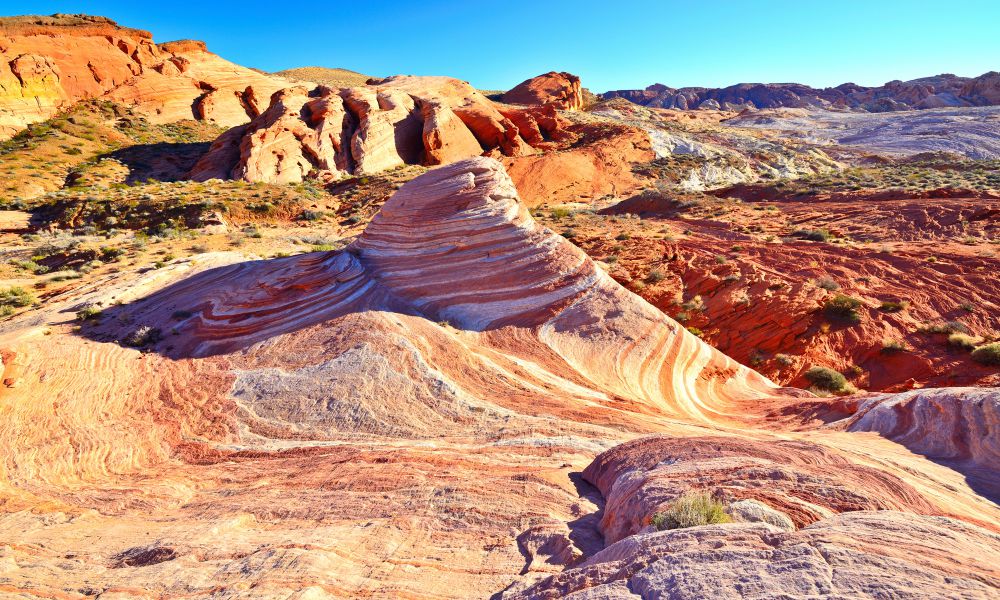
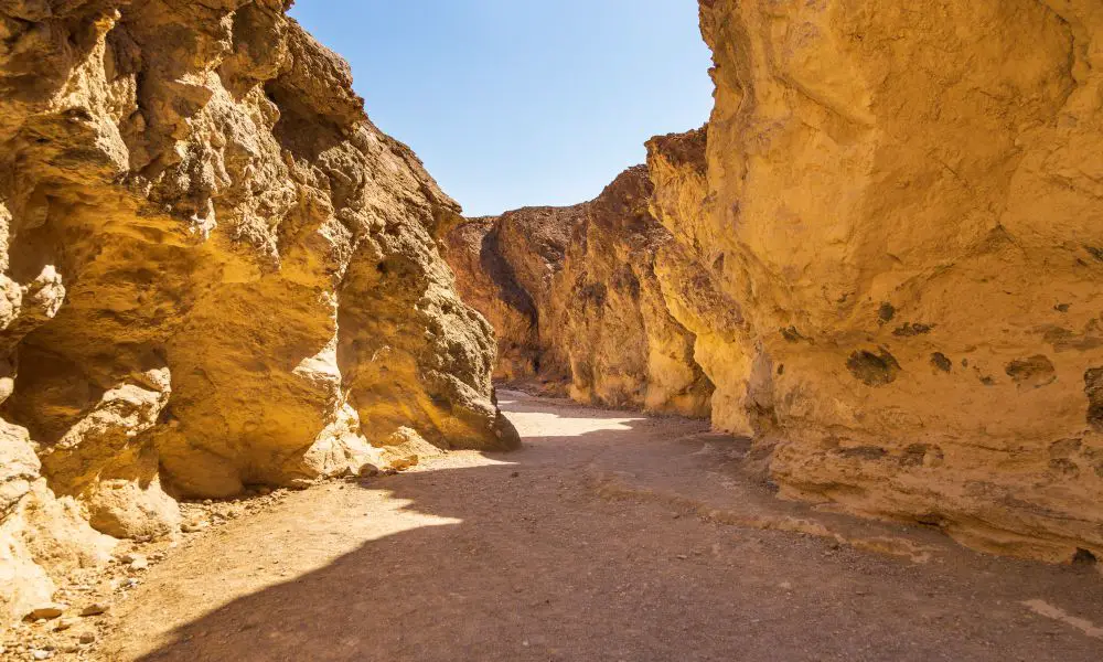
5. White Domes
• Distance: 1.0 miles
• Difficulty: Easy
• Elevation Gain: 177 feet
• Location: Valley of Fire State Park
The White Domes are another must-see stop in the Valley of Fire State Park. The white and red sandstone formations in this area are truly a sight to behold. The white sandstone formations get their color from the iron oxide that is present in the rock. The formations were created by millions of years of erosion from wind and rain.
The 1.0-mile out-and-back trail is easy, with an elevation gain of only 177 feet. The trail starts out flat and then descends into a series of colorful stone stairs. The trail then winds its way through small a small area surrounded by rolling stone hills, huge rock fins, and boulders. I suggest you take your time and explore all the nooks and crannies of this unique landscape.
As with the Fire Wave, the biggest challenge is the heat. However, the views from the trail make it one of the best hikes near Las Vegas. Hike early in the morning or evening to avoid the heat, and be sure to bring plenty of sunscreens, water, and a hat. The light is also better for photography in the late afternoon.
6. Golden Canyon
• Distance: 2.9 miles
• Difficulty: Moderate
• Elevation Gain: 575 feet
• Location: Death Valley National Park
Death Valley is the largest national park in the contiguous United States and one of the most diverse. It’s also one of the hottest, driest, and lowest places on Earth. But despite its name, Death Valley is full of life.
The Golden Canyon is one of the most popular hikes in Death Valley National Park. The 2.9-mile out-and-back hike is moderate, with an elevation gain of 575 feet. The trail begins at Badwater Road, which is about 3 miles south of the Highway 190 intersection.
The highlight of the hike is the waves of the golden ridges and canyons that the trail takes you through. The colors are created by different minerals in the rocks, and they change as the light shifts throughout the day.
And since you’re in the largest national park in the contiguous United States, there are plenty of other trails to explore in the area. Some of the other popular hikes include Gower Gulch, a 4.2-mile loop that takes you through a canyon to a natural spring, and Zabriskie Point, a 0.5-mile out-and-back hike with views of the valley below. There are more hikes in the area as well, so be sure to explore and find the ones that suit your interests.
The best time to hike the Golden Canyon is in the cooler months, from October to April. But if you hike in the summer, start early in the morning to avoid the heat. And with its diverse landscape that has some of the best hiking trails near Las Vegas, Death Valley National Park is a must-visit for any nature lover.
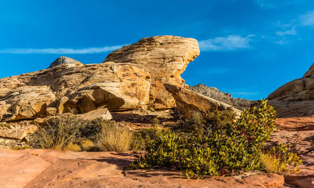
7. Calico Tanks
• Distance: 2.5 miles
• Difficulty: Moderate
• Elevation Gain: 580 feet
• Location: Red Rock Canyon National Conservation Area
This is a great trail for those who want to experience the best of Red Rock Canyon without committing to a long hike. This moderate trail will need you to scramble up a few boulder sections, but it is doable for most people.
So, what makes this one of the best hikes near Las Vegas? The views, of course! From the top of Calico Tanks, you’ll be treated to some of the most incredible views in the area. And, since the trail is only 2.5 miles long, you won’t need to spend all day hiking to enjoy them.
The trailhead for Calico Tanks is located just off the park’s Scenic Drive in Sandstone Quarry. The first part of the trail is a gradual uphill climb that you will need to use your hands for balance in a few sections. The trail then flattens out, and you’ll come across two smaller Tanks.
The final push to the top is the most challenging, as you’ll need to scramble up boulders and rock formations. However, the views from the top are more than worth it. From the top of Calico Tanks, you can see all the way to the Las Vegas Strip. Carry plenty of water and snacks, as there is little shade on this trail.
8. Goldstrike Hot Springs
• Distance: 6 miles
• Difficulty: Hard
• Elevation Gain: 1,460 feet
• Location: Lake Mead National Recreation Area
The Goldstrike Hot Springs hike is one of those challenging hikes with a reward at the end. Just bear in mind that this is not an ordinary hike, as you’ll be required to navigate eight fixed ropes along the way. And for this reason, it’s not recommended for beginners or those uncomfortable with heights.
But if you’re up for the challenge, the Goldstrike Hot Springs trail is one of the best hiking trails near Las Vegas that you should try. The payoff, in the end, is worth it, as you can take a dip in the hot springs to relax your muscles after a long and strenuous hike.
The trailhead is located just off Highway 93, about an hour’s drive from the city. The hike starts on a gravel path that descends into a canyon and the Colorado River. After about two miles, you’ll reach the first set of fixed ropes. From here, the hike becomes more challenging as you make your way up and down the canyon walls.
At the trail’s end, you’ll find the Goldstrike Hot Springs, located in a small alcove. The water is hot, so be sure to take a dip slowly. There are also cold springs nearby if you need to cool down. After enjoying the hot springs, you can relax and take in the stunning views of the canyon before making your way back to the trailhead.
This is an advanced hike, so be prepared and take all necessary precautions. Wear sturdy shoes rather than flip-flops or tennis shoes, as the fixed ropes can be slippery. It’s also a good idea to bring gloves to protect your hands from the ropes.
9. Charleston Peak
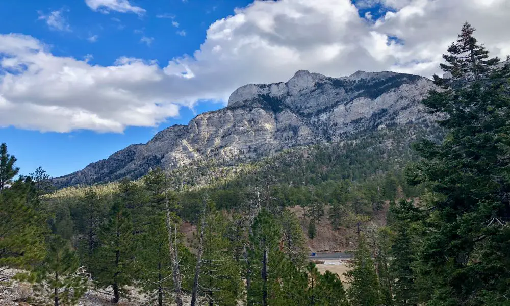
• Distance: 17.2 miles
• Difficulty: Hard
• Elevation Gain: 4,819 feet
• Location: Spring Mountains
Are you looking for more challenging hikes near Las Vegas? Or maybe you want to summit the highest peak in the state of Nevada. Either way, Charleston Peak is the hike for you.
Charleston Peak is the tallest mountain in the Spring Mountains, and at 11,916 feet, it’s the tallest peak in Nevada. The hike to the summit is 17.2 miles, with an elevation gain of 4,819 feet. This is definitely not a hike for beginners as the trail is long and strenuous, with several steep sections.
The trail starts at Cathedral Rock Parking Area and winds its way through the forested areas of the Spring Mountains. As you gain elevation, the trees will give way to lush meadows and eventually to rocky alpine terrain. The last mile or so is the most difficult, as you’ll be scrambling over large rocks to reach the summit. The summit offers stunning 360-degree views of the Southern Nevada desert. You may even be able to see the lights of Las Vegas in the distance.
I recommend doing this hike in two days, camping overnight at one of the many campsites along the way.
But you don’t have to hike to the summit to enjoy the beauty of Charleston Peak. There are many trails in the area that winds through the mountain and offer views of the rocky alpine terrain. Just be sure to wear proper footwear and bring plenty of water, as the altitude can make hiking challenging.
10. Mary Jane Falls
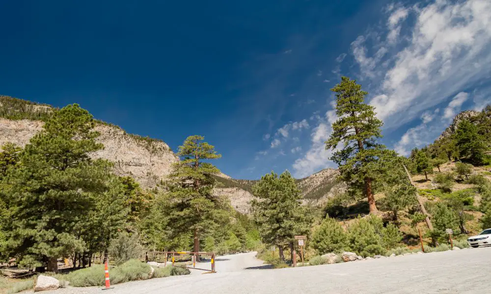
• Distance: 2.9 miles
• Difficulty: Moderate
• Elevation Gain: 980 feet
• Location: Spring Mountains
If you’re looking for waterfall hikes around Las Vegas, Mary Jane Falls is a perfect choice. This trail is one of the most popular in the Spring Mountains as it’s relatively short and easy, with a beautiful payoff at the end.
The trailhead for Mary Jane Falls is located at Kyle Canyon, about an hour’s drive from the city. The first half-mile of the hike is through a forest before things get a bit more challenging. The remainder of the hike will include switchbacks and some steep sections before looping back around to the waterfall.
Take your time to marvel at the beautiful waterfall and enjoy the peaceful surroundings. You can have your picnic lunch here before heading back the way you came. Or, if you feel more adventurous, you can continue the hike to the nearby caves, which add an extra half mile to the trip.
In Summary
You can’t go wrong with any of the options on this list of the best hiking trails near Las Vegas. Each trail offers something unique: stunning views, challenging terrain, or otherworldly scenery. And with so many trails to choose from, you’re sure to find one that’s perfect for you.